Orthoimagery
 The Montana Spatial Data Infrastructure (MSDI) Imagery Framework layer relies solely on the imagery products produced by the National Agricultural Imagery Program (NAIP).
About
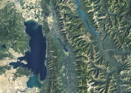
Digital orthoimagery are georeferenced images of the Earth’s surface. Displacement of objects has been removed for sensor distortions and orientation and for terrain relief.
Many geographic features, including those that are part of the Framework, can be interpreted and compiled from an orthoimage. Orthoimages can also serve as a backdrop to reference the results of an application to the landscape.
Access the Orthoimagery collection the following ways:
- Browse the collection online through the
- Montana Air Photo Browser
- Montana Digital Atlas
- Montana State Library web map services
- Order Aerial Photos - Users can order aerial photos in TIFF format.
- Download aerial imagery files for use with your software
Imagery Working Group
- Next Meeting: April 17, 2024, 2:00pm - 3:00pm
- In Person at the 2024 Big Sky GeoCon in Billings, MT
- Agenda draft
- March 20, 2024, 9:00am - 11:00am, online
- February 14, 2024, 9:00am - 11:00am, online
- Imagery Summit & Working Group Meeting - December 12 - 13, 2023
- February 8, 2018 - Agenda | Slides
- November 14, 2017 - USDA Presentation on NAIP Licensed Model to FGDC
- March 16, 2017 - Agenda | Presentation Slides
- November 22, 2016 - Agenda | Meeting Notes
Download Imagery
This collection of Downloadable Aerial Photographs of Montana includes:
- Compressed county mosaics of the NAIP images for 2005, 2009, 2011, 2013, 2015, 2017, 2019, and 2021
- Statewide USGS black and white digital orthophotos collected between 1946-1977, and 1990-2003, and
- Several regional air photo collections.
View Web Services
Web Services for National Agricultural Imagery Program (NAIP) Data:
- 2021, Natural Color and Infrared
- 2019, Natural Color and Infrared
- 2017, Natural Color and Infrared
- 2015, Natural Color and Infrared
- 2013, Natural Color and Infrared
- 2011, Natural Color and Infrared
- 2009, Natural Color and Infrared
- 2005, Natural Color
- 2005, Infrared
Web Services of Historic Imagery:
- 1990-2003, USGS Digital Orthophoto Quarter Quadrangles (DOQQs)
- 1946-1977, Aerial Images from the USGS Single Frame Archive (Mid 20th Century)
Future Collections
- NAIP for Montana is typically collected every two years. It was last collected in 2023. The NAIP 2023 Compressed County Mosaics are now available from the Geospatial Data Gateway.
Applications
Montana Air Photo Browser
This is a web application for viewing the web services listed above
Comparison of Montana's Landscape: 2015 & 2017 Imagery
Additional Sources of Aerial Imagery
Montana State Library Air Photo Collection
U.S. Geological Survey Aerial Photo Finder
U.S. Dept of Agriculture Aerial Photography Field Office
NRCS Geospatial Data Gateway
Theme Lead(s)
Erin Fashoway
Montana State Library
efashoway@mt.gov
(406) 444-9013
